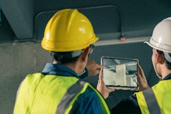
Reducing or eliminating construction discrepancies has been a significant focus for many of the innovations coming to construction. Identifying discrepancies—deviations from the design--reduces rework, cost and timeline..
These discrepancies need to be managed, with some being accepted while others requiring rework—and rework can be blamed according to one study for 3.53% of total project cost and more than 46% of cost overruns.
From clash detection in construction design software and building information management (BIM), to modular and offsite construction software that moves value creation into controlled environments, emerging and established vendors are bringing technologies together in new ways to chip away at that value leakage. In the emerging field printer category of construction robotics, products from Dusty Robotics and HP are addressing the problem by printing the plans right on the floor of a project, eliminating errors and also streamlining the work of trade contractors.
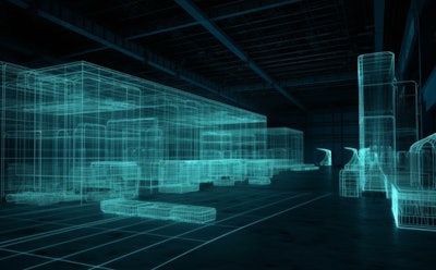
Reality capture vendor Avvir approaches the problem with point clouds and photogrammetry, relying on the accuracy of LIDAR to grab real-time insights on progress and use machine vision technology not just to calculate progress but to identify discrepancies. Avvir can also ingest construction photogrammetry data, but according to Avvir Product Manager Brad Shapiro, point clouds are the go-to for spotting discrepancies between work in place on site and a building information model (BIM).
Construction Software for Quality Control
In product release notes for Q2 of 2023, the company rolled out enhancements intended to improve usability, many of them focused on making it easier to disposition and manage discrepancies as they are spotted by the technology.
“We have a new grouping feature which enables users to group elements and groups of deviated elements,” Shapiro said. “These deviations of course are instances where materials, components or systems are installed differently than intended. Avvir users can now group them and take action instead of acting on individual issues.”
Shapiro said Avvir has a substantial moat around their product for production tracking based on laser scans to the level of granularity the company’s product can achieve as reality capture is compared to the model. But what about unmodeled elements of the project?
“We have announced a change to our 5D model-based production tracking for earned value of production put in place,” Shapiro said. “The pre-existing product compares work in the field to the schedule of values or work breakdown structure (WBS). We have had a strong product here, but what we didn’t have was a good way to track unmodeled line items in a project These are line items that might not tie back to a modeled piece of geometry. A good example of that is concrete formwork. Our customers will typically model concrete, but it is not that often that contractors are modeling formwork. That makes it hard for us to do line-item tracking for those items in the estimate.”
To close this gap, Avvir has launched 5D recipes, which tie unmodeled line items into a recipe for the modeled components in the BIM.
“If concrete is 50% complete, it is safe to say that concrete formwork is 50%complete,” Shapiro said. “It is enables us to encompass much more of a project estimate in our production tracking platform now that we have that 5D recipe feature.”
Apart from point clouds, Avvir supports drone photogrammetry and capture and images from handheld cameras, but mostly Avvir consumes data from terrestrial tripod-mounted or handheld laser scanners like the Navvis DLX or the Leica BLK2GO. There is an existing integration with DroneDeploy, which manages not just management of the photogrammetry files from drone-mounted 360-degree images, but the drone flight as well. According to Shapiro, this integration excels at turning photogrammetry data into point cloud data.
Customers using Avvir software for tracking against the schedule or tracking against the estimate can often get by with just 360-degree photos. But according to Shapiro, the point cloud data is a go-to for Avvir customers using their quality control functionality for deviation analysis.
“We need point cloud data for that,” Shapiro said. “At least 50% of our customers are interested in that deviation analysis, and those customers are out there grabbing point clouds for deviations.”
Application for Payment Software
Competitors like Openspace and Buildots are duking it out building progress tracking further towards automating application for payment. Avvir’s capabilities in this area are more aimed at general contractors engaged in pay application verification—ensuring that pay applications from a subcontractor reflect actual earned value on site.
READ OUR CONSTRUCTION PHOTOGRAMMETRY WIKI
“If a trade is billing for 50%, it is easy to go into the Avvir portal and see how much they have actually installed,” Shapiro said. “Is it 50%? Is it 40%? Maybe there are some deviations. We have some users that rely heavily on Avvir for validation of their pay applications.”
While general contractors make up the bulk of the Avvir customer base, subs use it to reference their own numbers and check their line items and the progress on their payment application.
“Our 5D product runs top to bottom,” Shapiro said. “We have subcontractors that use our 5D product right now to reference their numbers before they submit them to the general contractor. So they will log in and check their line items and the progress we’ve measured to shore up what they are submitting and make sure they are not mis-submitting something they haven’t calculated accurately. We have generals using the platform to vet pay applications against progress. And we have ownership keeping tabs on the estimate and the earned value.”
Part of Hexagon
In October of 2022, Avvir was acquired by Hexagon, which had acquired related brands including Leica. According to Shapiro, this creates new opportunities for Avvir and its customers as links are forged between other products in the Hexagon family.
That same year, Hexagon bought iConstruct, an Australian building information modeling (BIM) software company. Hexagon has also owned Leica Geosystems since 2005, and in August of 2022 purchased a Ghana-based Leica Geosystems distributor. Other companies that touch construction in the Hexagon portfolio include:
- Mining software companies Mintec and MiPlan
- LiDAR technology company SigmaSpace
- 3D city modeling tech vendor GTA Geoinformatik
- Allen Precision Equipment, a dealer and services partner for surveying and construction products
- Aerial acquisition company Northwest Geomatics
- Survey equipment manufacturer SCSS Survey, robotics
- Infor's former enterprise asset management (EAM) software
Shapiro was particularly enthusiastic about the potential of working with Multivista, a services arm of Hexagon that runs the largest pilot-controlled drone fleet in the construction space.
“We get direct contact with Leica and their laser scanning platform, Multivista, and there is that whole assortment of tools where we have a direct in with so we can look at creating some interesting integrations,” Shapiro said.


