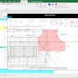
BidScreen XL, an Excel add-in, quantity takeoff application, gives you the power to takeoff your electronic plans directly in Microsoft Excel. BidScreen XL provides an outstanding audit trail while automating and speeding up the time consuming takeoff process.Takeoffs are a snap, just click on a spreadsheet cell and measure and identify areas, lengths and counts from your digital drawing files.
Overview
SiteWorx/OS is state of the art software that creates surface models and accurately calculates site excavation quantities. SiteWorx/OS is easy, affordable and does everything that you need. Speed, productivity, accuracy, estimating confidence and profits are increased as a result of SiteWorx/OS. AutoCAD DWG files are provided with GNSS positioning and elevations for machine control.
Features
Accurately and quickly calculate cut, fill and sub-grade material volumes
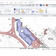
Easily record project boundaries, topsoil strip and re-spread areas, contour lines, sloping design lines, spot elevations, borings, trench details and areas with subgrade materials
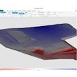
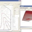
Clear audit trial with 3D models of the existing and proposed sites along with the location of cuts and fills
SiteWorx will works easily with PDF, vector PDF, DWG, DXF and other raster and vector file formats
Import contour lines, points and elevations in seconds from DWG files
Takeoff contour lines with a single mouse click from vector files
Select and isolate design layers from vector files
Snap to the object to obtain unmatched accuracy from vector files
Easy trace contour lines from raster files
SiteWorx project files can contain various file types
Keyboard shortcut keys activate arc and other commands
Ability to copy areas and exclude these areas from topsoil re-spread regions
Over-excavate and backfill volumes are easily computed
Trench materials and volumes are disclosed separately
Extensive, informative reporting with 3D graphics and clear, concise reporting of volumes
Displays the existing and proposed elevations with the cut/fill depths at any point on the 3D surface model
Site balancing adjustment provided
Boring log input gives cut volumes by soil type
Automatic checking reduces errors
Easy to find and edit incorrect elevations
Export results to Microsoft Excel, Word, PDF and other file formats
Copy results and easily paste into Excel and other applications
GPS surface model points can be exported as a CSV or DWG file
SiteWorx is cloud storage capable by saving the project and grading files to any cloud storage drive
Ability to export the takeoff as a DWG fileSiteWorx/OS Version 10 is now available

