Construction Site Drones
While Mazur and Wisniewski see a more active role for drones, drones in construction are today primarily focused on data capture and photogrammetry. The specific application depends on the type of construction a contractor is performing and the nature of the capture a contractor desires.
Drones for Horizontal Construction Contractors
For horizontal construction, a drone will overfly the site either on a fixed pattern or anecdotally to capture specific activities or parts of the project, so the resulting photogrammetry data can be merged with a building information management (BIM) or even geographic information system (GIS). For a large site, a fixed wing drone is often used as they may have a longer range than multi-rotor drones.
Drones for Vertical Construction Contractors
Vertical contracting like mid-rise or high-rise construction ban benefit from photogrammetry of structural erection, façade work, and mechanicals prior to being obscured by concrete. Here, the vertical and over capabilities of a multi-rotor UAV are essential, as is visual control of the drone within steel structures or near a roof, GPS may become unreliable. Obstacle avoidance features also become desirable in vertical construction, particularly in confined areas.
3DR (3D Robotics)
AgEagle Aerial Systems
Ascent Aerosystems
Commaris
DJI
Drone Logbook
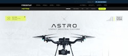
Freefly Systems
Identified Technologies
While Mazur and Wisniewski see a more active role for drones, drones in construction are today primarily focused on data capture and photogrammetry. The specific application depends on the type of construction a contractor is performing and the nature of the capture a contractor desires.
Drones for Horizontal Construction Contractors
For horizontal construction, a drone will overfly the site either on a fixed pattern or anecdotally to capture specific activities or parts of the project, so the resulting photogrammetry data can be merged with a building information management (BIM) or even geographic information system (GIS). For a large site, a fixed wing drone is often used as they may have a longer range than multi-rotor drones.
Drones for Vertical Construction Contractors
Vertical contracting like mid-rise or high-rise construction ban benefit from photogrammetry of structural erection, façade work, and mechanicals prior to being obscured by concrete. Here, the vertical and over capabilities of a multi-rotor UAV are essential, as is visual control of the drone within steel structures or near a roof, GPS may become unreliable. Obstacle avoidance features also become desirable in vertical construction, particularly in confined areas.
- Regulators are leaning towards approving drone use cases. The Matternet M2 UAS, for instance, in 2022 became the first unmanned non-military aircraft to achieve Type Certification from the Federal Aviation Administration (FAA), paving the way for commonplace drone delivery service and other beyond visual line of sight (BVLOS) use cases. The FAA has a BVLOS Rulemaking Committee, chartered in 2021, whose reports and recommendations should pave the way for increased reliance on drones for multiple construction use cases.
- As LIDAR becomes more heavily used, multi-rotor drones and those capable of carrying the heavier payload will become more widely used. Heavier drones and payloads are riskier to use overhead, which gives lighter-weight, fixed-wing drones staying power in the market.
- The Blue UAS List is affecting government drone usage, not only for defense and federal government applications, but other units of government as well. The origin of this movement, apart from private lobbying As drone makers including industry leader DJI are sanctioned for participation in persecution of China’s Uyghur minority or ties to the Chinese military, state governments including Florida have imposed similar restrictions on state agencies' drone programs. This places a premium on compliant drone hardware, which could be constrained. Drone restrictions may also hop the fence into the contracting sector if government entities use Blue UAS compliance as a selection criterion or if contractors begin standardizing on approved drones in order to position themselves to government project owners.
- More interoperability between drones and drone software. As drones come to market with gimbals to allow movement of the camera or other reality capture device, software will be able to optimize the flight path and/or image capture to reduce fly time and shorten data processing time. Reorienting a camera angle can just by itself reduce the amount of data involved in photogrammetry of linear assets, for instance, when the camera is moved to portrait rather than landscape mode. Drone flight planning, management and data processing software must evolve to leverage these features, which could mean closer partnerships between drone manufacturers and supporting software vendors.
- Some commercial drones are becoming more capable of operation under adverse conditions, including high winds and precipitation. These features will be marketed initially to first responders, police and disaster response sectors, but construction contractors can also consider them for mission-critical work or when data capture is time-sensitive.
- Quantity capture and project planning during pre-construction of vertical projects
- Regular overflys of horizontal projects to drive progress reporting and as-built
- As-built data capture of mechanicals prior to wall enclosure in vertical construction
- Inspection of vertical and horizontal projects for quality control and reporting
- Progress tracking to support application for payment. Drones equipped with either light-based cameras or LIDAR capture site data. Machine vision applications can then compare captures on from different times to ascertain progress, often calculating volume of production to the point where the data can be used for application for payment or dispute resolution.
- Estimating quantities in pre-construction or in storage. Horizontal contractors and materials suppliers may use drone photogrammetry to determine volumes and quantities required for construction, either in terms of materials to be added like fill or dirt to be removed or moved through excavation. Materials suppliers may also use drones to support inventory functions by assessing the size of stockpiles.
- Site logistics planning for ingress/egress and traffic flow. Determining the best route for trucks over an undeveloped site and determining how ingress and egress can be positioned to minimize disruption of the community can both make for a faster and more accurate site planning process. Topographic information collected may also support drainage, stormwater and other utilities planning.
- Health, safety and the environment (HSE) management and tracking. Drones can document compliance with safety regulations and best practices for reporting and forensic purposes.
- Quality documentation and management. Drone photogrammetry comprises an as-built of the project to either identify quality noncompliance so it can be corrected or to document performance against quality tolerances for application for payment or at project closeout.
- Risk mitigation and litigation support. Granular documentation of the project is a compelling tool in proving performance against a contract. With an active drone data capture program, a contractor can spend more time building and less time litigating and arguing.
- Inspection and Maintenance. Post-commissioning, drones can perform mandated inspection of assets including façade structures, linear assets like pipelines and infrastructure.
