Equipment
Technology
Workwear
Categories
For Sellers
Sign In
Search Site
Virtual Events
IRONPROS TV
Finance
Premium Content
Expert Columns
Product Categories
Technology and Software
Site Data Capture
Site Data Capture
Company
Product
Aggregates
Asphalt & Pavement
Concrete
Earthmoving
Equipment Financing
Landclearing
Lawncare
Lifting
Other Accessories
Portable Power
Snow Removal
Product Categories
Technology and Software
Site Data Capture
Augmented or Virtual Reality Systems
Drone Systems
Electronic Distance Measurement
Photogrammetry
Trucks & Trailers
Underground Construction
Workwear
Yardwork
Enter search phrase
Search
76 Results
Type: Product
Section: Product Categories > Technology and Software > Site Data Capture
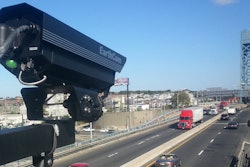
24 MegapixelCam Advanced
EarthCam Inc.
Industry-leading time-lapse and live video 24 MegapixelCam Advanced Professional heavy-duty fixed position DSLR time-lapse camera with live video preview is ideal for long-term projects in demanding environments.
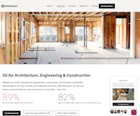
3D for Architecture, Engineering and Construction
Matterport
3D for Architecture, Engineering & ConstructionWhether you work in architecture, engineering, or construction, you'll be able to streamline documentation, 3D scan as-builts, and collaborate with ease.
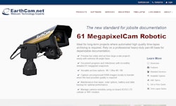
61 MegapixelCam Robotic
EarthCam Inc.
Document milestones with ultra-high resolution, 61MP panoramic imagery, precise heavy-duty pan-tilt camera.
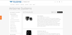
Air borne Systems
Teledyne FLIR
The Star SAFIRE® 380X is a hardware, firmware, and software upgrade to support advanced image aiding features for our globally renowned Star SAFIRE 380 gimbal systems, including Star SAFIRE 380-HD and 380-HDc.
Avvir
AVVIR
How were steering the built world into the future.Avvir wants to give you complete knowledge of your build, at any time, and we believe the best way to do that is during construction.
BeamerOne
LightYX
Turn 2D/3D blueprints into interactive field tools by projecting them on jobsite surfaces using an accurate laser.
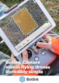
Botlink Capture
Botlink
We understand that not everyone wants to be a pilot, but still see the value in adding drones to their toolbox.
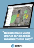
Botlink InSites Stockpile Mapping Software
Botlink
Evolve the work site with Botlinks stockpile measurement tool. Increase frequency of data collection, lower costs, and discover the size of stockpiles within minutes.
Cintoo Cloud
Cintoo
The Cintoo Solution Cintoo Cloud is a cloud-based Reality Data management and collaboration platform.
Cities
Geopogo
Present building designs in their urban contextin cities around the world For successful architects, urban planners,and commercial developers
Constru
Constru is building the future of efficiency, leveraging breakthrough computer vision technology to offer verifiably accurate project status for early defect detection and truly optimized scheduling.
Construction Estimating 101
ConX
Easy to use cloud based measuring tool for quantity and material takeoffs.No more printing plans and spending hours in the office.
Construction Jobsite Management Platform
EcamSecure, a Gradaworld company
Manage and monitor any even the most remote jobsites at your convenience.
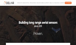
Delair Drones
Delair
Delair professional fixed wing drones are the ideal tool for aerial data acquisition faster and further.
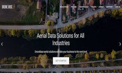
Drone Base
Dronebase
Get the aerial property inspection imagery, analysis, and reporting you need to process a claim or underwriting inspection Overview The DroneBase API enables enterprises to work with us at scale.
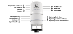
EarthCam Expands Live Weather Service for Construction
EarthCam Inc.
New onsite weather station combined with live imagery strengthens EarthCam’s visual data ecosystem.
Evercam - Construction Cameras
Evercam
At Evercam we have designed each of our features to solve problems on construction sites everyday.
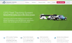
FleetCam
Forward Thinking Systems
The all-in-one fleet vehicle camera system designed to save lives with AI driver assistance, real-time in-cab notifications, and an integrated driver behavior coaching system.
Page 1 of 5
Next Page