3D modeling Software & CAD (Earthworks)
3D Modeling Software & CAD Explained
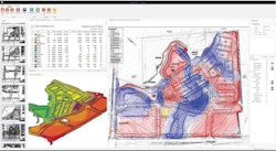
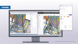
Drawings in two dimensions that have elevation data added become 3D models. The ability to design and represent data in 3 dimensions creates multiple efficiencies for contractors, designers, and building teams. Construction software for 3D modeling can include design, GIS, lidar, and other tools that plot data in space.
10 Results

Page 1 of 1