OpenSpace may lead the market in photogrammetry software for construction, but on a May briefing IRONPROS got caught up on new functionality recently pushed to market to make photogrammetry more of an enterprise solution and enhance usability in the field.
OpenSpace Director of Product, OS Capture & Growth Richard Acton-Maher and OpenSpace Vice President of Product Neel Sheth helped us get caught up and prepared to cover product announcements to come at Waypoint 2023, their annual virtual summit.
Field Productivity Focus
Sheth said a major focus for the product team in recent months has been the user experience of field-based users.
“We are focusing a lot on feedback from our customers about what they appreciate in our approach, making things really simple, easy to use, and ultimately deployable,” Sheth said. “And a ton of the feedback we get is about making things easier to use in the field. In a release announced in March, we are homing in on a number of features that we started prioritizing, much higher, much more highly this year—making things really easy for the field to use.”
This March release includes:
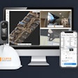
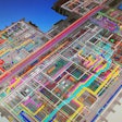
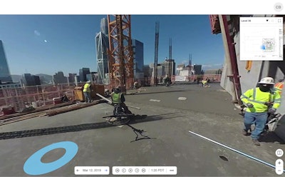
- The mobile app feature BIM Compare, which enables field workers to easily navigate and view their model side-by-side with actual site conditions.
- Capture heatmaps to show which areas of the jobsite have been previously captured and which areas have been missed to ensure an entire site is documented.
- QuickConnect, which speeds the handshake between cameras and the mobile app
- In the OpenSpace Field Notes tool, which captures ad hoc insights from the site with note callouts on a 360° image capture, enhancements include the ability to close out those notes once they are addressed, and a search function
Other features, including customizable tags that will enable a construction team to use notes more aggressively to track activity or productivity in the field, are coming soon, according to Sheth. This increased flexibility to support interactions between the field and front office starts to make it look like OpenSpace could wind up interacting with or notching out some usage for field productivity software products like Sage Field Operations, Assignar, Raken and others—if primarily in vertical construction environments. These products serve to connect work packages defined in project management software to crews, workers and equipment and then capture and report on productivity, ultimately to drive application for payment.
In the IRONPROS multivendor marketplace, construction field productivity software is one of the most active sectors. In the 2023 State of the Industry Construction Technology Report, almost 20% of respondents were planning or budgeting for field productivity management software and another 34% were already using it. Construction photogrammetry software, the category OpenSpace falls into most directly, sees 32% of respondents planning or budgeting for an expenditure and 26% already using the technology. Based on what Sheth and Acton-Maher said about the OpenSpace product direction, as integrations get these two types of construction software products to talk to speak the same language, they will have more and more to say to each other.
“Absolutely, there's going to be convergence,” Acton-Maher said. “We started, obviously, from the standpoint of capturing what has been done on site. And then we started to move towards the middle through defect detection and defect tracking, which is what Fieldnotes was originally used for. But we've already started to get a further towards tracking not just defects but progress on site. We allow for manual progress tracking, or at least manually verified progress tracking so you can see what our AI says about progress but then also look and verify it has been done. Next, we're starting to look at progress tracking against the BIM model, so that you can get a better sense not just of a defect in what's been built, but what's left to build. And so that gets you closer to the other side of the spectrum. I think there is a continuum from manual progress tracking and automated progress tracking against the BIM.”
Ultimately, this approach by OpenSpace could support not just insights about progress against the plan but sequencing and project tasks.
“In our progress tracking product, we need to be able to say how many square feet of drywall have been installed,” Acton-Maher said. “But for work planning purposes, if you can determine that some drywall has been installed on this floor, it might be useful to start directing the work that needs to be done next. If the framing is done, the drywall can go up next door. We will continue to move in that direction as we have, but certainly, our center of gravity is always going to be reality capture.”
READ THE IRONPROS OPENSPACE PRODUCT DEEP DIVE
This convergence could mirror the January 2023 move by OpenSpace, which had focused on wearable 360 degree cameras, to add drone support for the Insta360 Sphere, which can be attached to the DJI Mavic Air 2 and Air 2S drones. OpenSpace also announced an enhanced Procore integration that included tighter links between Procore RFIs and Observations and OpenSpace Fieldnotes. OpenSpace CEO Jeevan Kalanithi at least holding open the possibility of integrating the machine vision-centric OpenSpace Track with Procore for progress reporting.
“I think there's a lot of opportunities there,” Kalanithi said when asked if that type of functionality would also integrate with Procore in the future. “For sure. We have a list of things, and that is one thing that I think could be cool.”
What’s Coming at Waypoint?
Acton-Maher and Sheth also gave IRONPROS a confidential preview of some Waypoint announcements, and we can confirm there will be substantial developments rolled out at this annual user conference. These will go beyond incremental functionality improvements and take the OpenSpace product potentially into new use cases. The company has regularly added data capture modalities, from LiDAR to drones, and we anticipate this theme will be revisited at Waypoint.
Waypoint should also bring news of more tools to help detect deviations between reality capture and the plan, and further enhancement of the machine learning application running beneath the progress tracking components of OpenSpace.
A final theme we expect to see addressed in announcements at Waypoint is how OpenSpace can talk to systems of record not just about the construction project, but the built asset.
